Thursday, 11 October 2012


Sunday October 7, 2012

We decided to stay in Elizabeth City Monday morning to get groceries.  We learned from the Visitor’s Centre that Farm Fresh would send a vehicle to pick us up, get our groceries & bring us back to the boat for free.  So we took advantage of this.  Ed, the young man who picked us up also gave us a bit of a tour of some of the older homes in Elizabeth City.  

Elizabeth City is known among boaters for a group called the “Rose Buddies”.  This started in the early 80’s when Fred Fearing & Joe Kramer welcomed boaters by giving all the ladies roses from Joe’s rose garden.  Even though both have passed, away a group has formed called the “Rose Buddies”, who have continued the tradition of welcoming boaters to Elizabeth City.  Any time 5 or more boats arrive at the wharf, they hold an impromptu wine & cheese party.  There were 7 boats at the wharf, so we were invited to a wine & cheese party Monday afternoon.  There were 3 speakers & we got to meet the other boaters.  One of the “Rose Buddies” gave us advice on when to cross Albemarle Sound & how to get around the shoaling at the entrance to the Alligator River.  

The weather wasn’t good on Tuesday for crossing Albemarle Sound so we decided to stay an extra day & got caught up on some boat chores in the morning.  In the afternoon we toured the local museum.  

Wednesday was calling for rain & a chance of thunderstorms in the afternoon, but the morning was looking good for crossing Albemarle Sound.  So we decided to sail down the Pasquotank River, across the Sound & just into the Alligator River.  We stopped for the nite at the Alligator River Marina, & were able to get fuel & a pump out before the rain started.  They had a small restaurant in back of their gas station/variety store.  So we treated ourselves to dinner out.  Dave asked the waitress if there really were alligators in the river & she told us about the 12 to 14 foot one they had in the harbour last year.  He asked how they got rid of it & she explained that they had to just wait until it left on it’s own, as they are a protected species in North Carolina.  They had alligator bites on the menu, so we ordered them to try.  The waitress was quick to point out that they imported their alligator from Louisana, & was not from North Carolina.  The alligator bites were really tasty, similiar in colour & texture to chicken.  

Thursday we left & headed up the Alligator River to the Alligator River - Pungo River Canal.  We ended our day anchored in a bay just off the start of the Pungo River.  After supper, while we were sitting in the cockpit watching a beautiful sunset, Dave spotted something in the water swimming across the bay.  It turned out to be a black bear.  We could tell when he reached the other side because of all the dogs barking.  

We went down the Pungo River, through the Bay River & Gale Creek, through a series of canals.  As we were just about to enter the Neuse River, we hit a shoal hard enough that I thought the bow was going to go under the water & Dave thought the propeller had come out of the water.  We were able to back off but were not able to find a way through the channel until a boater from North Carolina came along & said he had no problem going through this area.  We ducked in behind him & followed him all the way through, thankfully.  We had planned to anchor off of the Neuse River in Broad Creek.  When we got to the anchorage, it was very shallow, & after our earlier experience, we didn’t feel comfortable being in water that shallow.  We had passed the entrance channel to a marina, that we had read about, on the way in to the anchorage, so we decided to try it out.  Grace Harbour at River Dunes is part of a planned community that was started just as the economy went bad.  As we entered the channel, the homes alongside it, looked like they came right out of “Gone With The Wind”. So we decided to stay an extra night to take advantage of some of the amenities that they had available.  

Sunday we headed for Morehead City, NC.  When we arrived, there was a Seafood Festival going on so we walked over to it.  Our Thanksgiving meal included shrimp, flounder, crab cakes & hush puppies, but no turkey.


The "Rose Buddies" rose bushes in Elizabeth City, NC 

Club House at Grace Harbour at River Dunes, NC

House on the ICW anything goes for colour here

Tuesday, 2 October 2012


Monday October 1, 2012

We left Solomons Island early in the morning & headed for Deltaville, VA.  Dave had heard of Dozier’s Regatta Point Marina.  We thought we would try it since it would make a shorter run to Norfolk, VA the next day.  It was the nicest marina we’ve been to so far!  It was cheap, beautifully landscaped, clean, & had lots of facilities.  The marina owner is the publisher of the Waterway Guides & the Skipper Bob publications.  

Tuesday morning we left for Norfolk, we got about an hour south on the Chesapeake. The wind was gusting to 15 knots coming out of the south, the current was coming in and and the waves were about 3 foot.  We decided that this was not going to be a fun sail and turned around and went back to Dozier’s Marina.  

The weather conditions were the same Wednesday so we stayed again.  We borrowed their courtesy car & went into Deltaville & did errands.  Dave got his first hair cut since being away.  It turned out okay, even though he was warned not to get a certain lady.  We spent the afternoon doing odds & ends on the boat.  

We decided to try going to Yorktown to Riverwalk Landing Marina.  As we were approaching Riverwalk,      Dave saw a dolphin off the stern of the boat.  This was the closest we’ve been to them!  We are finding the guide books have a tendency to embellish the facilities.  Riverwalk had no wind protection, & there was a good foot & a half swell in the harbour, plus nothing was close-by to see.  So we left & got a slip in a marina across the York River.  The only attraction we ended up seeing was a Wal-mart Supercentre - our first since leaving Port Elgin.  

Friday morning we left for Norfolk, VA.  We were able to sail part way down the York River to the Chesapeake Bay.  Then the winds died & we just motored the rest of the way.  Norfolk is the world’s largest naval facility & it is huge!  We saw 4 or 5 aircraft carriers plus numerous other large naval vessels, which we had no idea what they were.  These were all being protected by helicopters, small patrol boats & jet fighters.  Needless to say, we didn’t go for a close up look.  We ended our day at Waterside Marina, about 6 miles north of the start of the Intracoastal Waterway.  

The next morning we headed south to the start of the ICW in the rain.  After going through the Gilmerton Highway Bascule Bridge, we left the military/industrial area of Norfolk & entered a rural creek on our way to the Great Dismal Swamp Canal.  There’s a lock at both ends of the canal that maintain the water level 8 feet higher than the waterway in & out of the canal.  The canal was dug by hand, by slaves & is maintained at a minimum depth of 6 & half feet.  The depth sounder showed between 6 & a half feet & 8 & a half feet, but we still managed to find a dozen spots to polish the bottom of the keel.  We stopped at the Visitor’s Centre for the night & tied to their dock.  Also checked out the Dismal Swamp State Park Visitor’s Centre on the other side of the canal.  

Sunday we locked down into the Pasquotank River from the canal.  This stretch of waterway was more what we had envisioned as a swamp than the Dismal Swamp Canal.  It had different kinds of over-hanging trees, small animals like turtles, birds, butterflies, & one snake.  The water surface was covered with duckweed, which is a lime green colour & floats on top of the water.  The bow of the boat cuts a path through it and leaves a brown stripe behind from all the tannin that is in the water. We ended our day in Elizabeth City, NC, known for providing legendary hospitality to waterway travelers.  


Some of the Naval Vessels in Norfolk, Virginia


Time 2 Go at the Dismal swamp Canal Visitor's Centre


Places we've been and places still to come

Pasquotank River after leaving the Dismal Swamp Canal

Tannin coloured water trail

Duck weed covers the whole Pasquotank River the wild life don't seem to mind but tough on cooling water strainers

Tuesday, 25 September 2012

Leaving Chesapeake City for Annapolis, Maryland

Mooring field in Annapolis, Maryland

Waterman's Competition at Solomans Island, Maryland

Monday, 24 September 2012


Monday Sept. 24, 2012

Dave spoke to one of the guys in the anchorage in the Cohansey River about the tides & he said he was leaving at 7:00 am., so we followed him out.  We had a really good run, up the rest of Delaware Bay & saw 8.2 knots on the way.  We entered the Chesapeake & Delaware Canal about 12:30 pm.  The canal is designed to handle large ocean going vessels including navy ships, but the only thing we saw was power boats & other sailboats.  We had been pushing for several days to get as far inland as we could, to avoid bad weather we’d been hearing about since leaving Atlantic Highlands.  We got a dock in Chesapeake City to wait out the storm.  The owner of the Chesapeake Inn, Restaurant & Marina was kind enough to give Dave a ride to a convenience store several miles away, for milk.  Later we walked into town to a crab restaurant & ordered crab cakes, & one crab.  The waitress gave Dave a lesson on how to eat crab.  The lady at the table next to us thought it was really funny that Dave had ordered one crab, as her husband had just devoured 3 dozen.  

Tuesday the storm finally arrived.  The hazardous weather warnings on the radio were going all day so we stayed close to the boat & caught up on things.  

We were up early Wednesday morning & blew up the dingy & mounted it back on the dingy-tow.  We were off to Annapolis, going against the tide again.  We had the sails both up today, getting some of the best sailing in we’ve had since we left home.  We arrived late to Annapolis in time to find ourselves in the middle of a sailboat race.  It is a huge mecca for pleasure boats of all sizes & we had trouble finding the mooring balls at first.  

Thursday morning we got a water taxi to go ashore.  We had hoped to go to a West Marine & a grocery store & get back & do an oil change on the boat.  With the time it took us to get to West Marine on the bus, water taxi, & return, we were unable to get groceries.  Based on the guide books we figured we could get groceries at our next stop.  With a new pump we bought at West Marine, the oil change went alot smoother this time. 

We left heading south for Solomons Island.  There were several large freighters anchored in the bay, waiting for the tide to turn.  But not us, we were taking it on the nose again.  It was a quiet trip down the Chesapeake until we realized we were sailing through a target range for the U.S. Air Force.  We did a quick 90 degree turn & got out of there real quick!  We seemed to be the only ones that had spotted that on the charts.  Several other boats just sailed through the whole area without incident.  We arrived at Solomons Island late afternoon, tying up to their fuel dock.  When we inquired about a grocery store, we found it was 4 or 5 miles away.  Shortly after we arrived, a 39’ catamaran came in & tied up across the fuel dock from us. The owners, Steve & Gwen were a really nice couple who used to keep their old boat at this marina.  They introduced us to their friends, Rusty & Lee.  Rusty is a local boat builder who has done an incredible job of upgrading & modifying his Morgan 43. 

We planned on staying put the next day due to another front coming through.  Rusty lent Steve & Gwen & us, his truck in the morning to go to West Marine & a grocery store.  Rusty told us about a different chart book for the ICW (Intracoastal Waterway).  They had one at West Marine & we bought it.  It looks pretty good & is very similiar to a CAA trip-tik.  Finally got stocked up on groceries as well.  The weather front finally came through Sataurday night, bringing some rain & high winds, which carried on into the morning. 

 We decided to stay an extra night & we caught up on a few boat jobs in the morning.  After lunch, we went to a Waterman’s competition & watched the local fisherman competing backing up their boats. This was a huge local event with people from all the surrounding area cheering on their favourite boat.

Tuesday, 18 September 2012


September 17, 2012

Monday we decided to stay in the Liberty anchorage due to high winds as a result of Hurricane Leslie.  Dave worked on the AIS system & finally got it working.  The Automatic Identification System (AIS) locates & warns of any large vessels in the area on the GPS.  When he connected the correct wire, the GPS went berserk with all the traffic on the Hudson River.  Took a few minutes to shut down all the alarms.  

By Tuesday morning we were starting to run low on supplies, so we headed for Atlantic Highlands.  There was a fair bit of river traffic until we got south of the Verrazano Narrows Bridge.  Then it was nice calm flat water to Atlantic Highlands where we picked up a mooring ball.  They had a very nice shuttle-launch service that would run you back & forth from your boat to land.  Dave found out he could carry a 10 pound propane tank in his backpack - this was our first fill-up since Port Elgin.  

Wednesday, our friends John & Sandra, from Princeton, NJ came & visited us.  We went out for lunch & tried Flounder for the first time & enjoyed it very much. We had a nice afternoon visiting with them at their home in Princeton.  

Thursday we left Atlantic Highlands & motor-sailed around Sandy Hook for our first bit of ocean sailing.  It was a nice introduction to the Atlantic with calm winds & swells less than a foot.  We had planned on stopping at Manasquan but arrived there too early in the day.  Conditions were good so we decided to carry on & go to Barnegat Inlet.  The channel was well marked but the fishing boats do not slow down for any reason.  Their wake made it challenging getting into the Inlet.  We used the anchorage written up in Skipper Bob, which had good holding.  This was the first time we noticed salt crystals all over the boat.  

Friday we had hoped to make it to Cape May but due to calm flat water & no wind, it became obvious that we could not make it before dark so we pulled into Atlantic City.  On the way, in the morning, we saw our first dolphins.  We had hoped to use an anchorage in Atlantic City.  The water was really shallow on the way in to this anchorage & with the tide still going out, we decided to go to a nearby marina by the  Golden Nugget Casino, rather than chance getting stuck in the anchorage.  

The long range forecast was not good for the first part of next week, so we started pushing to get inland.  Sataurday morning we left for Cape May in two to three foot swells, winds were 10 to 15 knots.  We were not able to sail much that day due to wind gusts up to 22 knots.  We arrived at Cape May & anchored east of the Coast Guard Station with several other sailboats.  

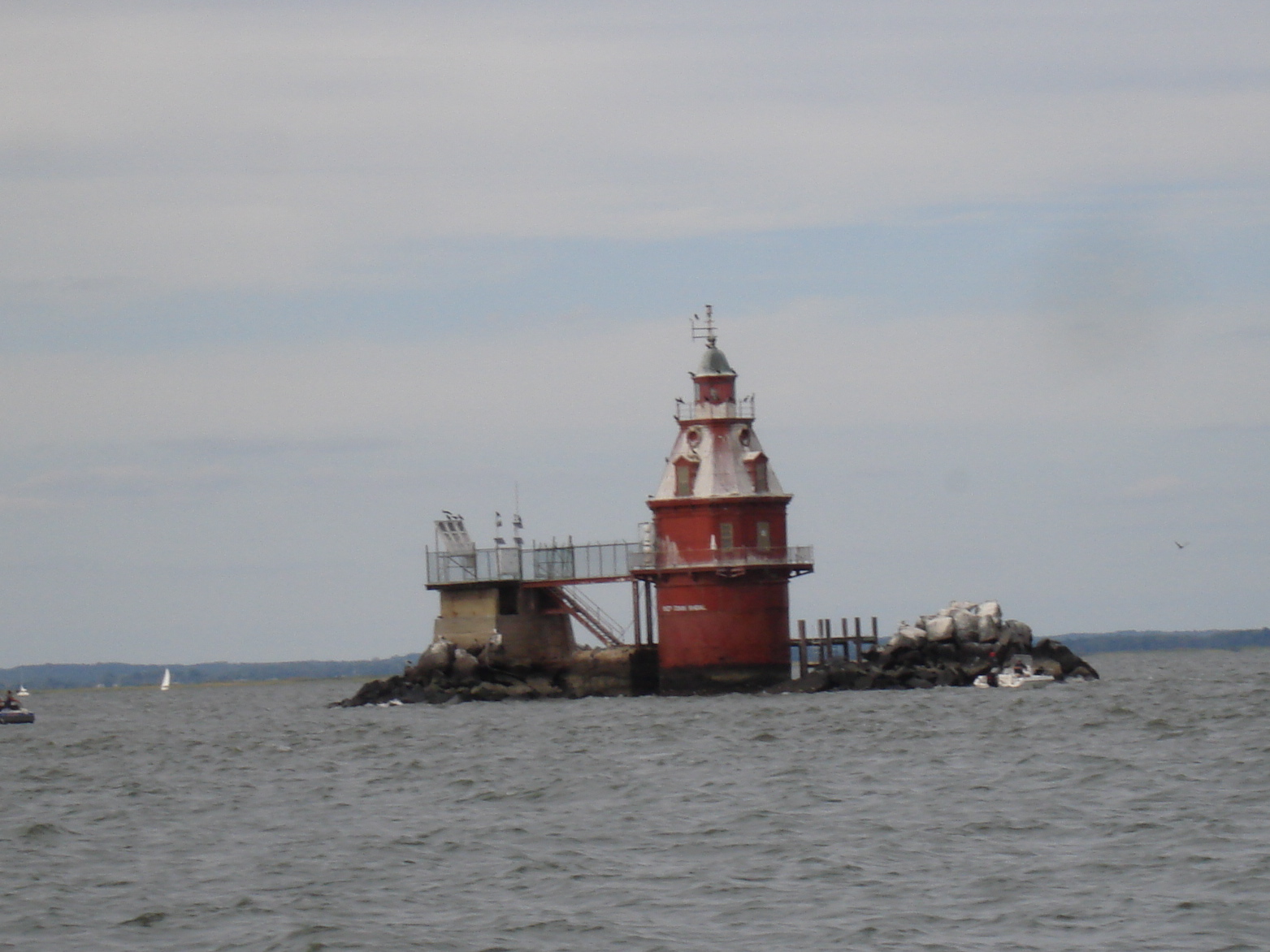
Sunday morning we started up the Cape May canal to Delaware Bay.  There are two 55 foot fixed elevation bridges that you have to go under on this canal.  With a 2 foot antenna, on top of a 40 foot mast, on top of our boat, you would swear that you were going to come out with 20 feet less on the other side of the bridge.  Scary.  We figured our calculations for the tides wrong, so they were against us all day.  The worst we saw was our speed down to 3 knots.  This slow progress meant we would not make it to the  end of the bay before dark so we decided to anchor in the Cohansey River.  The tidal current was very strong here & we had to reset the anchor twice during the night when the tide changed.   

Leaving New York City
Atlantic Ocean

Atlantic City, New Jersey

Ship John Shoal Lighthouse, Delaware Bay

Sunset in the Cohansey River anchorage


Friday, 14 September 2012


Mon. Sept. 10, 2012

We left Waterford in the morning & did Lock #1 at Troy, starting down the Hudson River.  We saw ‘Knot Yet’ in Albany as we headed south, but were unable to raise them on the  VHF radio.  The trip down the Hudson was not fun due to the huge number of power boaters who were out for the weekend.  We arrived at Riverview Marina in the afternoon & started getting prepped for the mast going up Tues. morning.  The crane operator & his assistant were really helpful getting the mast back up.  All went smoothly.  We spent the rest of the day doing rigging, putting the sails back up, laundry & odds & ends. 

Headed south again on Wed. & made it as far as Cornwall-on-Hudson.  The trip was more enjoyable this time, with the mast back in place & very few power boaters on the river.  Planned to anchor behind Pollepel Island but it looked tricky to get into.  We saw 2 sailboats anchored on the opposite side of the river, so decided to anchor there instead.  The Pollepel Island has the ruins of an interesting old castle.  

The architecture of the buildings along the Hudson are really spectacular.  From giant mansions, new & old, to West Point Military Academy & even the lighthouses were really neat.  This is the area where the families like the Vanderbuilts & DuPonts built their mansions & is still the choice of wealthy people today.  

We anchored early on Thurs. in Haverstraw Bay, across from a park.  Was very peaceful & quiet.  We decided we’d go to Half Moon Bay Marina the next day to catch up on groceries & use the internet, about 2 miles away.  The dockmaster was very helpful & took us into the town of Croton-on-Hudson. However, the only grocery store was a gourmet one & very expensive.  

Sat.’s plan was to go back to the anchorage 2 miles away to wait out bad weather in New York City.  The forecast Sat. morning was alot worse so we decided to stay another night in the marina.  It turned out to be a good decision because there were reports of tornadoes touching down in New York City & wind gusts up to 44 knots in the anchorage we were planning to go to.  

Sun. we left for Liberty State Park Anchorage located behind the Statue of Liberty.  The closer we got to Manhattan, the busier the river traffic became - loads of ferries, tour boats, water taxis of every size & description.  When we got to the Jersey City/Manhattan area the U.S. Coast Guard had 3/4’s of the river closed to traffic for a super-boat regatta.  This funneled all the traffic through a very narrow section of the river and meant we got up close & personal with a lot of these vessels.  It was a relief to finally pull in behind the Statue of Liberty to the Liberty State Park Anchorage.  It is a nice quiet anchorage with good holding. 


Lighthouse on the Hudson River

Mast going back up

Bannerman Castle on Pollepel Island

West Point Military Academy

New friend we made on the Hudson in Manhatten

Another new scary friend

Some of the security at the Super boat Regatta on the Hudson  River

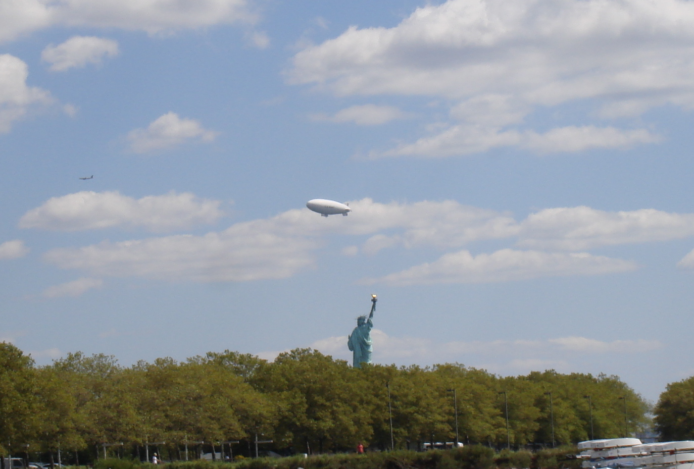
Statue of Liberty

Our view of the Statue from our anchorage


Tuesday, 4 September 2012

Lock 17 is the largest step 40 feet. The east gate raises up and we went under it, very wet.

 Anne at the wheel

 Amtrak line along the canal was very noisey

 Waterford Harbour Building